I chose this climb because it would put me at a new altitude record for bicycling – approximately 12,400 feet above sea level. It also crosses over the continental divide, which is pretty neat.
Mt Evans and Pikes’ Peak are both around 14,000. So if things went poorly on Trail Ridge, I knew I should not attempt those (or attempting my white whale – the full Mauna Kea in Hawaii.)
Technically you can start this climb down in the actual valley, and turn it into a 7500+ foot ascent, but since this was supposed to be a warm up ride for Evans/Pikes, I opted to leave from Estes Park, which has the added bonus of a breakfast place I can park at, so I can eat pancakes when I’m done riding.
I was obviously not on my game this morning, since it took me until 6 AM to get kitted up in the parking lot. Then I forgot to start my bike computer. Then I got .8 miles in and realized I left my camelbak hanging on my motorcycle.
So on my 3rd attempt of starting the climb, I headed up.
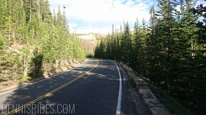

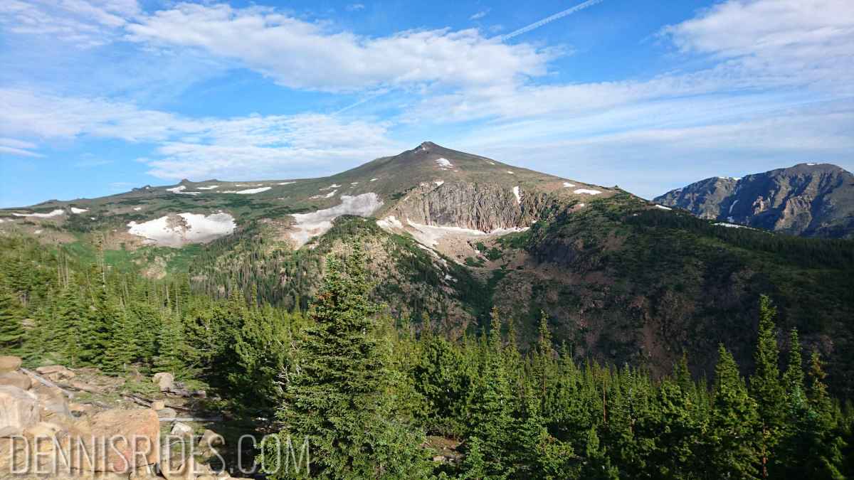
The first 2000+ feet are pretty much.. tree tunnels. Not much to be seen except the epic huge mountains in the background, and increasingly dire warnings about changing conditions. I was pretty much surrounded by dark clouds, and you could see lots of puddles from the previous day’s precipitation. I REALLY didn’t want to do the descent in the rain.


Around 11,000 feet.. you hit some gaps in the mountain, turns out, this is the divide. Apparently the west and the east weather systems are fighting it out, because the wind turned REAL gusty.
WIFE: STOP READING HERE
Alright, if you’re not my wife who worries about me – it was probably 40+ mph gusts for about 10 minutes. One picked me up and moved me a good 8 feet to the left – luckily to the side where there was mountain and not cliff.
I definitely was having second thoughts and considered turning around (since there was still another 30 or 40 minutes of climbing.)
Luckily by the time I was done waffling, some trees sprang up again to block the wind, and it wasn’t bad the rest of the way up. I suspect it’s just that continental divide thing.
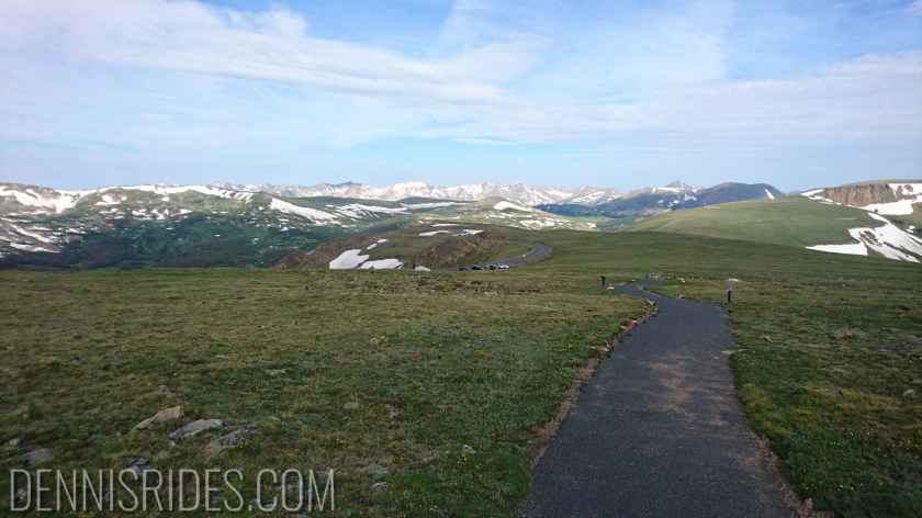
Once you get up past 11,000 or so, it turns into the now familiar arctic tundra.

There was actually another deer RIGHT on the shoulder, giving me the eyeball.. once again, no picture as I tried to figure out how to get past an animal larger than my motorcycle. Then I noticed it was chewing on a candy bar wrapper, so I figured it was distracted by whatever delicious treat an idiot tourist gave it. TOURISTS: WILD ANIMALS WILL KILL YOU, DO NOT FEED THEM. So dumb.
I continued over the summit (no sign?!?!) and down a bit of descent to a turnout area, there’s a paved trail that leads up a bit from here, so I decided to go up it – here I finally got to use my granny gear, as it was 15%+ in spots. Also a good test at 12,000 feet if I could power through something like that.
Generally I felt ok, slightly nauseated again – but hard to tell if that is altitude or just too many Pop Tarts and Lifesaver gummies. No dizziness or vertigo or anything like that.
My heart rate behaved much better – barely creeping up around 80% once I got over 10,000 feet, lowering my cadence seems to help significantly.
Alright, now the descent.. if my wife is still reading this she should stop again.
While I was dawdling at the summit, the weather degraded, it was now 25+mph pretty continuously, and the divide section was.. not good.
The only good part was that traffic going down was still quite light, while going up there was a steady stream of cars throwing off turbulance. But at least I could claim the whole lane – which was good, because I needed it – between the wind changing directions as I rounded switchbacks, and then the extra 40+ mph gusts coming through the divide, I was all over the road.
Thankfully it had not started to rain yet. After that andrenaline and white knuckle first 2000 feet, I pulled over and took a breather before tackling the rest.

The rest of the descent was also no fun, but not as scary, just very unpleasant. I meant to stop a few places and take more pictures – then another gust would pick me up and I’d change my mind.
I coasted into the breakfast place and got my victory pancakes, relatively confident I can attempt Evans and Pike’s Peak without immediate altitude sickness, assuming I can find an acceptable weather window.

um, yeah. Feel free to come home now. Sheesh.
LikeLike
Only fluffy kitten tea parties the rest of my trip! It’ll be fine.
LikeLike