After hiatus for being injured, fat, buying/selling houses, COVID, et cetera, I have resumed my not-very-urgent quest to ride the Top 100 road climbs in the USA.
A couple of weeks ago we spent the weekend in Santa Barbara and I took care of Gibraltar Rd (#62) and Refugio Rd (#70)
Gibraltar is pretty boring with a fair number of cars and a lot of close brushes with OHV toting pickup trucks, and Refugio was blasted to heck from the fires and mud slides. Really awful pavement made for a lonnng bumpy descent! But 2 more knocked out. This currently brings me to 26 out of 100 (a list that is somewhat ever changing as new climbs are added that push others down the list.)
Next up I am headed to San Diego to knock out #16 (Nate Harrison Grade) and #39 (Palomar.) Not too many non-snowed in opportunities in January.
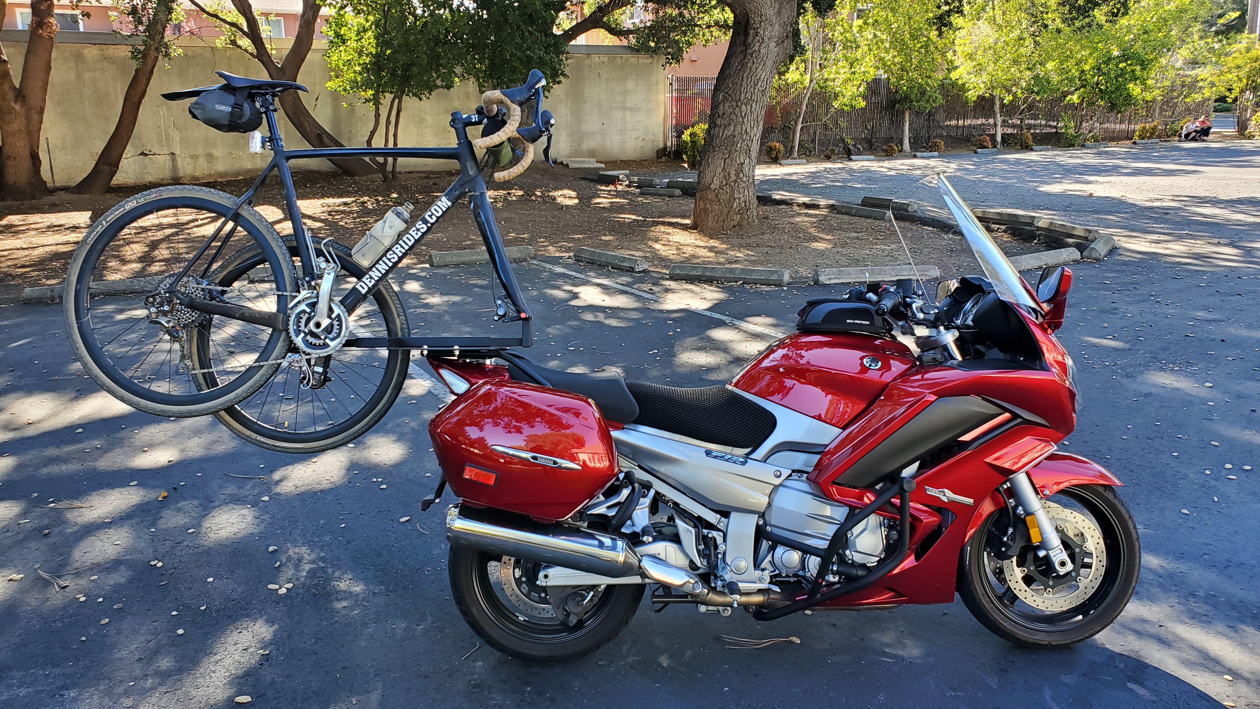
Taking the motorcycle-bicycle rig for this trip since I’m solo.
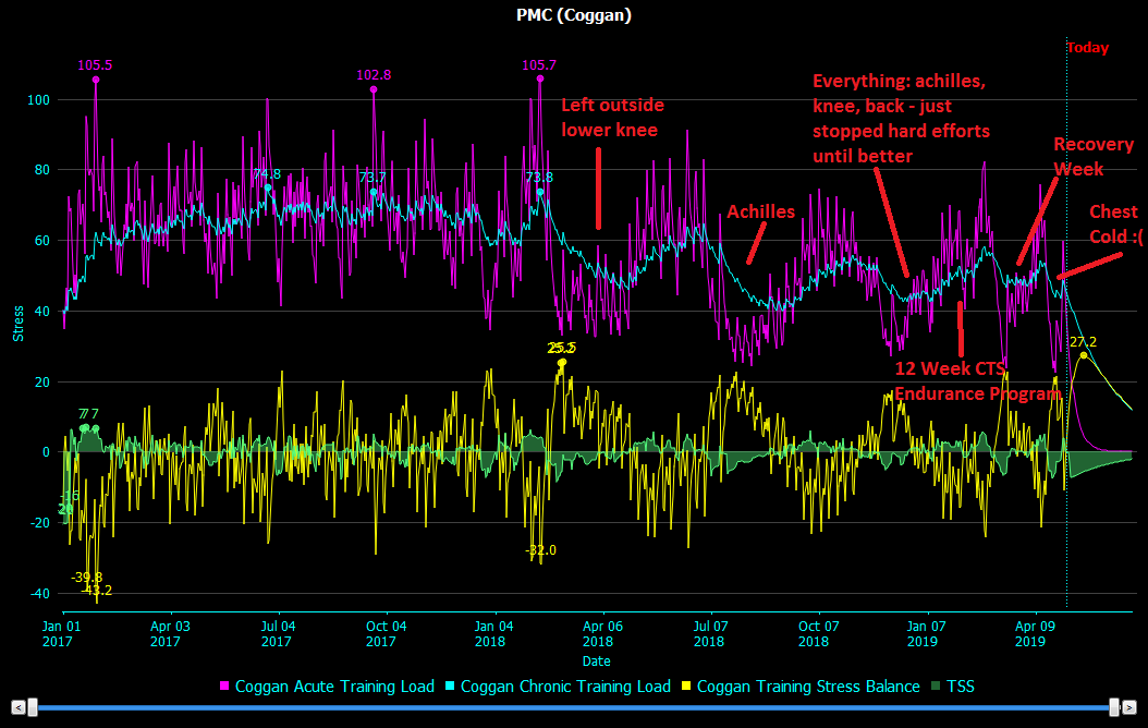
So here we are in September 2019, with hardly any updates. So what happened to 2018? The plan was: Double Century in March, Death Ride in July, then Mauna Kea (the hardest bike climb in the world) in August/September.
2018 reality (the light blue line is “training load” – ie, how fit you are and prepared to go ride up crazy mountains)
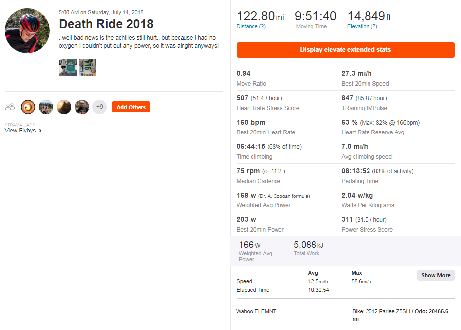
In short, the wheels fell off the wagon. I still managed to do Death Ride with the wonky Achilles but it wasn’t super fun: Strava Link
After a bust of 2018, I took some time off and gradually trained back up and lost all the weight I gained being injured, preparing for Mauna Kea in July 2019.
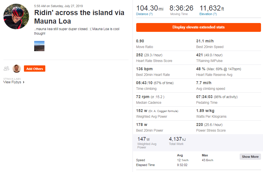
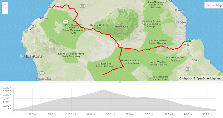
5 days before I left, the natives shut down the road(!) – could have been worse, I was meeting a buddy from the U.K. that flew over to do it.. so I couldn’t complain that much. But I did anyways. I still rode across the whole Big Island and up Mauna Loa, but I can’t help being disappointed. Strava Link
More importantly, here’s the new motorcycle and new 2×2 rack!
Some days ya eat the bear, and some days the bear eats you.
Plan was to motorcycle 400 miles to the foot of Mount Hood, bicycle up, then motorcycle 30 minutes to a cheap(er) motel than those in the area.
First 2 hours were not bad, boring but no traffic and making good time.. until you turn west to head toward Portland.
Relentless, awful wind.. 100s.. if not 1000s of wind mills, so apparently it is awful all the time. My left arm went numb from counter steering to the left for 1.5 hours of this, and then you drop down into the Columbia river gorge.. and this is even worse, by a lot.
Relentless, random buffeting, and heavy tractor trailer traffic. Exhausting and awful – I would never do this route again on a motorcycle.
Thankfully after another hour of this abuse, the Garmin beeped and said hang a left! yay!
Except it took me down some no where backroad.. and then told me to turn into a NF-xxx road. NF means “National Forest” which means.. no pavement.
Optimistically I went for it.. and it was okay for a couple miles.. then it hooked a sharp left straight up the mountain, up STEEP loose switchbacks. Running near slicks, I was roosting up dirt just to get up and around the turns.. I really wanted to turn around after 2 or 3 of them.. but it was so steep and loose I had to keep going for another half a mile before I could turn around. Going down as about as much fun, although at least I remembered to turn off my ABS before I hit the dirt at the start.
So after arguing with Garmin (GRAGE!) I got back on track, for another hour of the horrible gorge, which, if anything, got even worse while I was lost in the hills.
Finally, I was back on the correct road and another hour took me to the start of the climb.
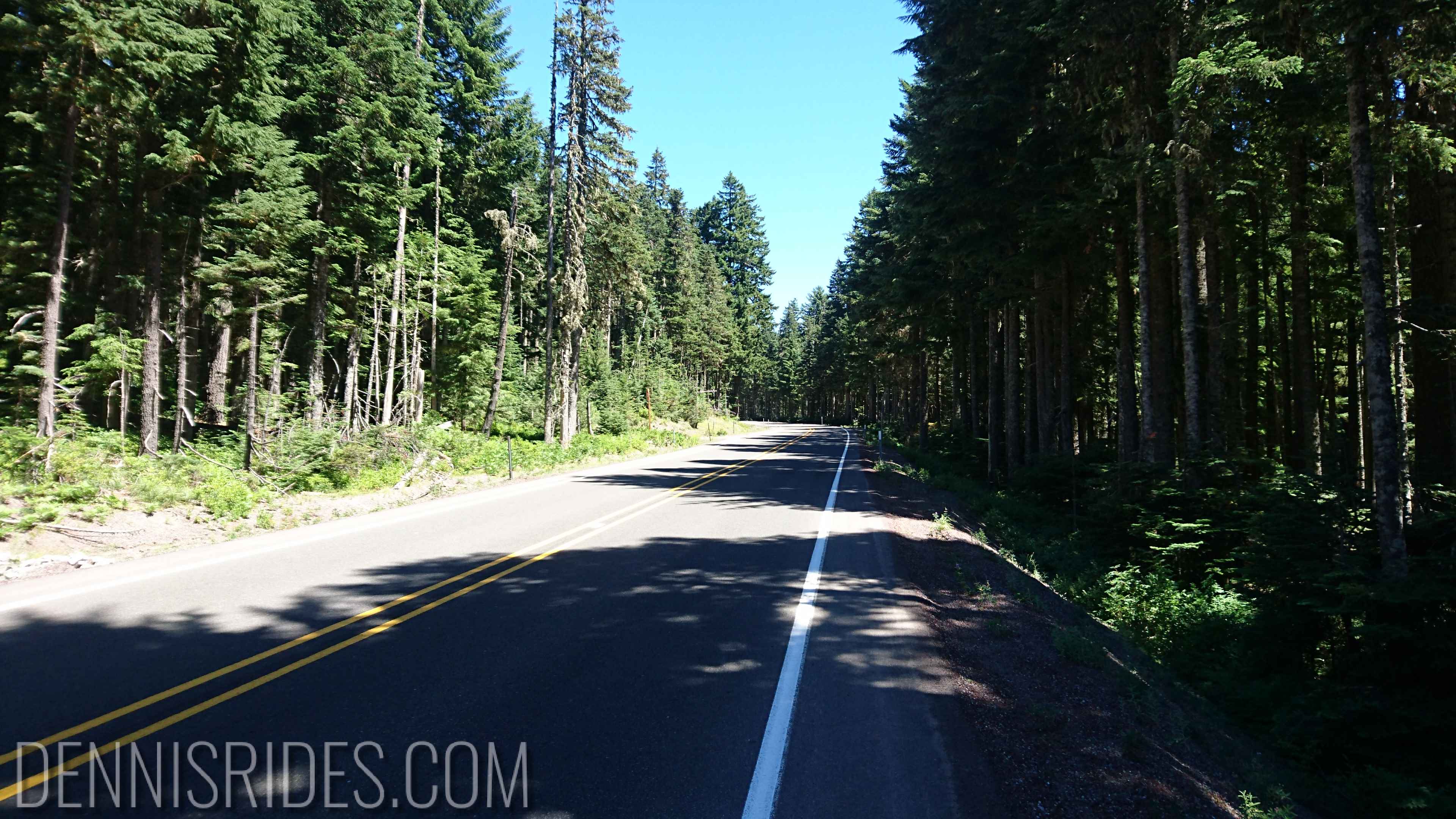
The climb basically goes up a highway, an EXTREMELY busy highway, with tons of tractor trailer and logging trucks. As far as I can tell, Oregon does not believe in a 3 foot rule.. I am pretty sure they think it is 3 inches.
And the wind was here too, relentless buffeting – a few times I thought I had a flat tire. Going up was bad, going down was really awful.
Luckily it was “only” a 2 hour climb and I was happy to get it done. I’d say this was the least fun climb (even ignoring the 450 miles of motorcycle tri
bulations) of the trip. Combined together, I am beat!
Tomorrow off to Mount Shasta, the final climb of my trip!
Finally, on the correct highway to Mt Hood
“Start” of the climb
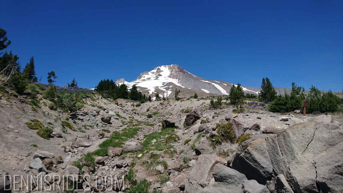
Pretty much the only thing you can see from the highway is Mt Hood!
Turn off to the ski park – plenty of snowboarders going up!
Gettin’ closer!
The top of the pavement – need a ski lift from here!
Going down – some other big mountain in the distance
Nothing exciting to report other than the thunderstorm pattern is setting up again, that may be the deciding factor tomorrow if I go for 2 climbs (7000ish feet of ascent) or 3 (11,000ish.)
Did some minor maintenance on the bicycle and motorcycle, rested up and worked on my plan home. Right now it is looking like:
Salmon, ID (no bicycling)
Mt Spokane, WA
Mt Hood, OR
Mt Shasta, CA
That would mean I did climbs in 8 states, which is pretty neat!
Short jog by motorcycle over to Westminster to visit an Internet buddy, amusingly he has been in the SF bay area several times, but always in San Francisco, and during the week, that 40 miles might as well be 100.. so it was just easier to ride my motorcycle 2000 miles than to go into SF from the South Bay.
Thanks Mike and his gracious wife for allowing a slightly scraggly motorcycle/bicyclist to hang out and take a break from hotels and bars.
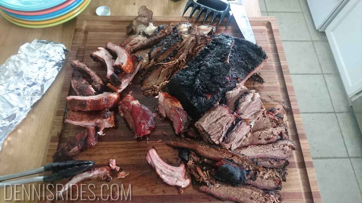
Plus, Mike cooks a mean brisket and ribs and has 2 cute cats!
Yum
“Scrambles”
“Daniel”
Tomorrow I head over to Manitou Springs and, weather holding, tackle Pike’s Peak on Monday.
After I updated yesterday, the thunderstorms rolled through in earnest, with legitimate rain and thunder, lightning and wind. Today’s forecast looked similarly bad, and I had no interest in tackling the ‘tooth in rainy, blustery conditions. Tomorrow is looking reasonable, so I decided to take a rest day – do some minor bicycle maintenance, adjust the chain on the motorcycle, check the oil, etc.
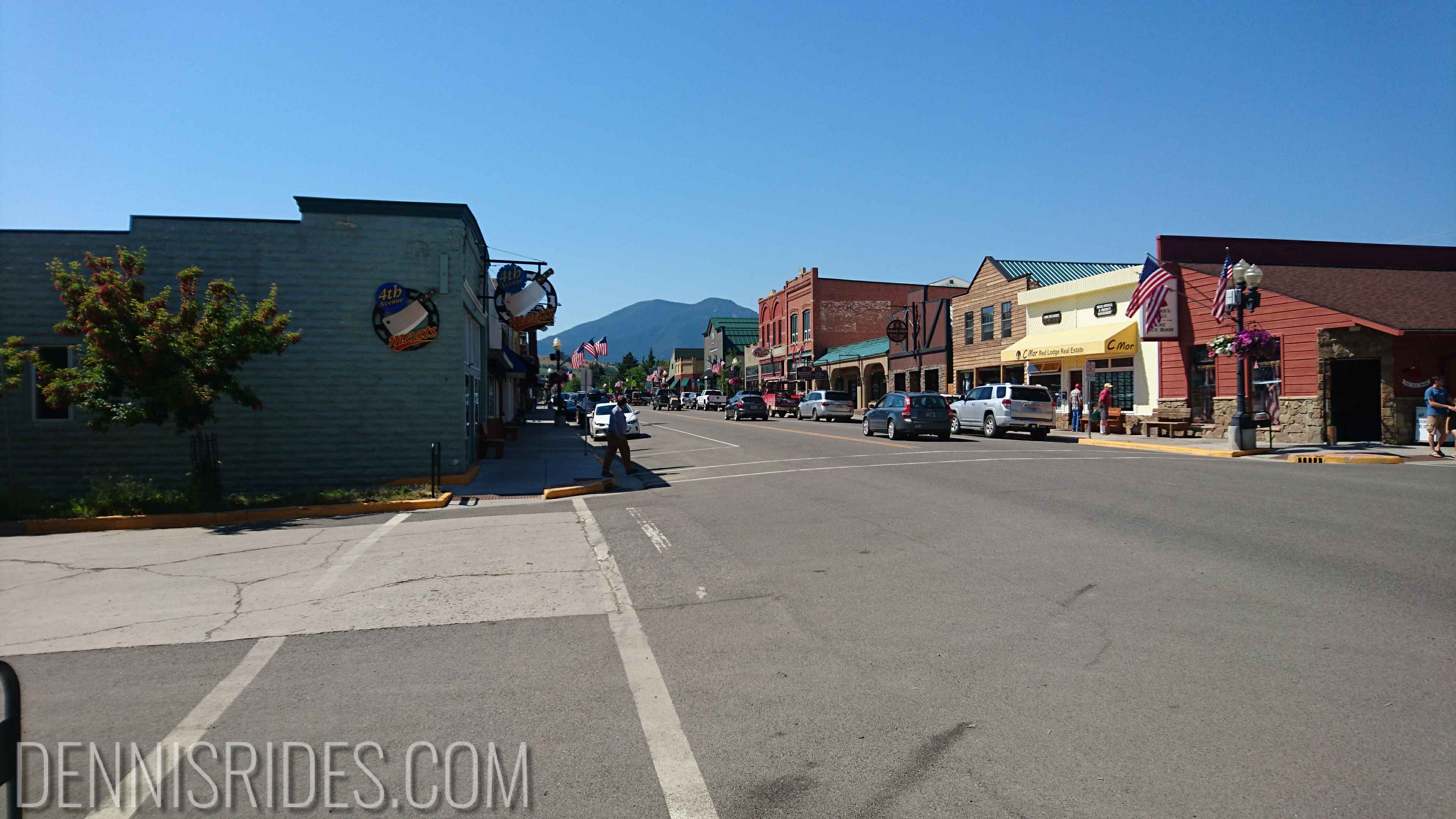
I spent the day puttering around Redlodge on my bicycle, acquiring breakfast for tomorrow, snacks, coffee, etc. As usual, finding food that wasn’t grilled or deep fried was a bit tricky. But it was a pleasure to be outside in reasonable temperatures instead of hiding from 95+ after noon time.
Assuming the weather holds, I’ll be headed to Greybull to tackle Granite Pass and Hwy 14 alt back-to-back. That would be 3 of the top 100 climbs in 4 days. I’m hoping the shorter motorcycle legs will mean I’m less beat down!
The weather remains the wild card, yesterday Shell, WY had flash flood warnings and 50 mph wind warnings – that’s the start of the Granite Pass climb, so we’ll see which way the weather whims go.
Morning Red Lodge
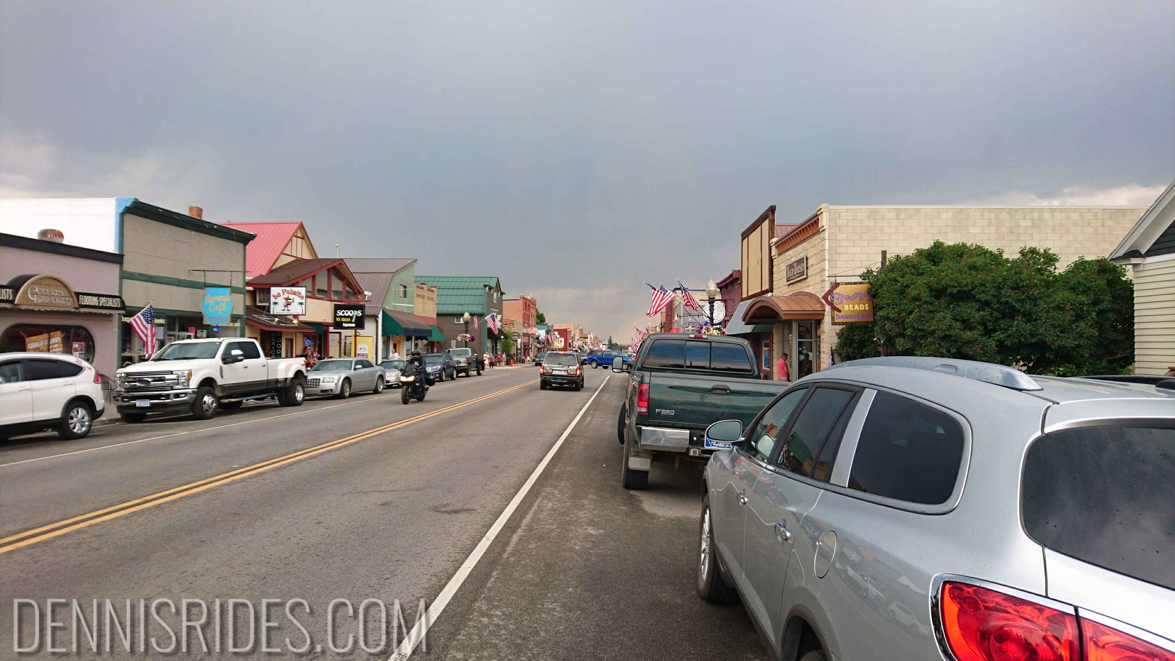
Ominous afternoon Red Lodge
All this heat is melting all the snow and the river next to my hotel looks awfully full, hopefully I don’t have to deal with floods too
You’ll note the lack of a title picture. Today was boring to ride, probably boring to relate, and probably boring to read about. But I’m trying to stay in the habit, so here goes.
I knew today was going to be pretty punishing, even before the heat, even from looking at the route on the map – it looked flat, boring, and straight. Typical high desert high speed droning. Definitely a “getting some where” not a “going some where” situation.
However, I come equipped for this sort of day – My Garmin Zumo has an XM radio, which is usually sufficient entertainment. This is a typical Garmin product, in that it works about 98% of the time, and then that 2% of the time, you scream in rage at it. I have dubbed this “graging.” Anyone with a garmin cyclocomputer that ate their ride data knows what I’m talking about.
In this case, the XM antenna was acting up saying “low” or “no” signal. Usually I bring spares of anything I’d be super sad about losing or breaking – so, books on tape, MP3 player, or something.. but for this trip, I pretty much shed all the extras to fit my bicycle stuff (I do have a spare bike GPS & HR strap – priorities!)
So I was about to face 500 miles of boring horror and started dismantling my electronics to see if it was a bad connection when I remembered: Garmin is incredibly stupid when it comes to Bluetooth.
Previously I had my GPS paired to my phone, but was putting it in Airplane mode to conserve battery life. Could Garmin be so stupid as to screw up their own XM antenna when a Bluetooth pairing is stuck in discovery?
YES GARMIN IS THAT STUPID. I disabled it and had XM radio again.
So, the ride:
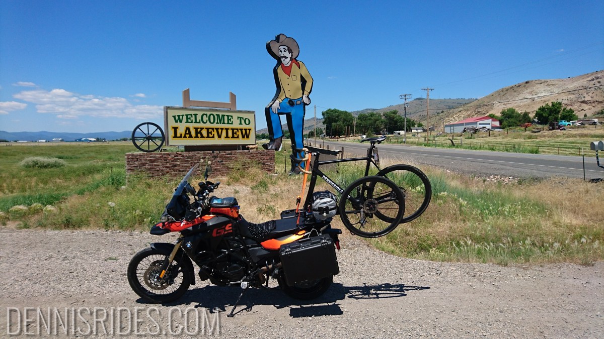
The first 100 miles were pretty nice, winding around a couple of lakes out of Lakeview.. then.. it was a 400 mile death march through the high desert.
The only excitement was a couple of cows trying to kill me, leaping randomly like deer, as almost all the open desert is free range, you have to be alert for critters like that.
That’s it, tomorrow I take “the rig” a short ~24 mile jaunt to the start of Mt Harrison for the first bicycling. My toe is still pretty sad, but in typical fashion, I will ignore it.
Around 500 miles on the motorcycle today. Definitely was feeling it around the 400ish mark, going to take a few days to ride into shape.
But the big deal is THE HEAT. It is going to be a big factor for my trip, forecasts are running 10 to 15 degrees above normal.
That makes a slightly unpleasant 85 degree ride into a very unpleasant 95 degree ride or a dangerous 100+ degree ride.
So today’s main goal was: Get past Redding before it hit 105(!)
I got up at 4:30, snuggled all the girls (wife and 2 cats) and headed out.
Since the goal was to make time, I headed for the mind numbing horror of the interstates – 680 to 505 to I5. I5 was the typical soul destroying drudge, but success – it had just hit 88 degrees (around 10 AM) when I turned off on Hwy 299.
299 takes you immediately up into the mountains and things cooled off, generally staying in the mid to upper 80s. Since I was past the risk of Redding, I stopped for lunch and then headed on into Lakeview, Oregon.
Motorcycle seems to be doing fine, but I have managed to slice open my pinky toe bashing it on my SPD pedals after pulling the bicycle off the motorcycle and perching it in my hotel room. Hopefully it will heal up before I start the bicycling.
Due to the heat, it’ll probably be another early early day tomorrow, and probably longer layovers than I originally planned. It pretty much cuts the day in half – no bicycling in the morning and then riding to the next city.
500 more miles to the first climb!
PS, while I was picking up Pop Tarts for the morning, I ran into someone doing the American Trail Race(!) – he was around mile 4,650, making my adventure look a bit shabby! Dylan was currently in the lead and full of energy.
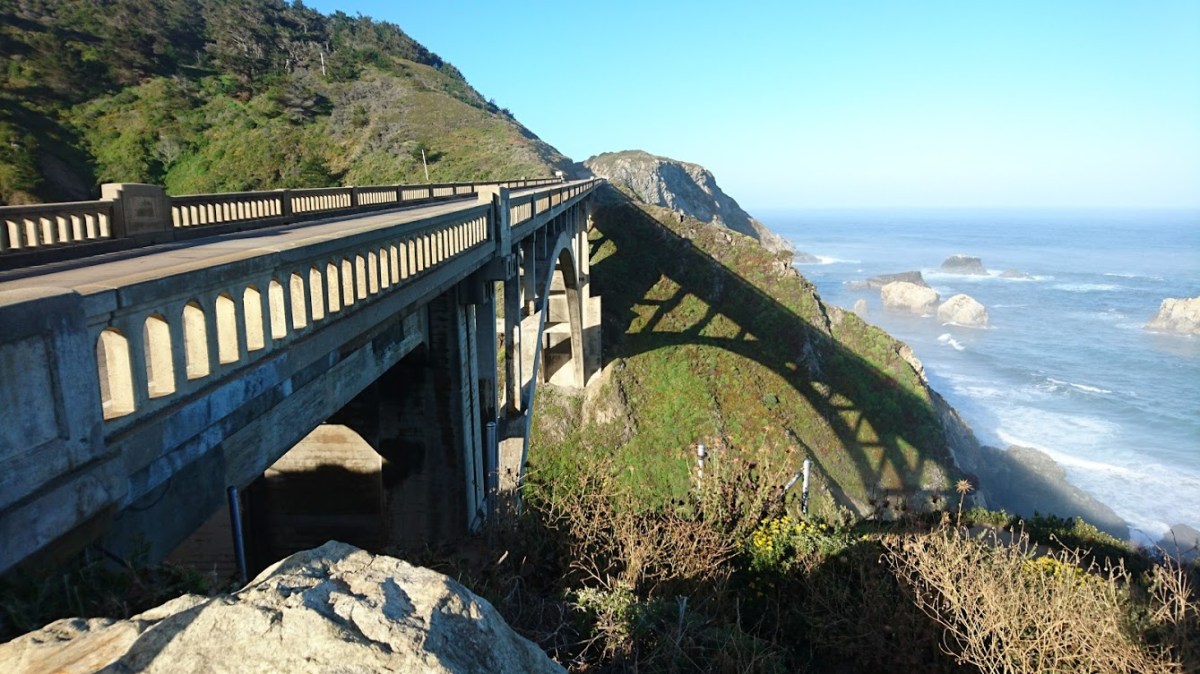
[Photo from a training ride down Highway 1 this past weekend]
Been a while since I updated, all the snow the western US has received was making my trip a bit dodgy, but the latest heat wave seems to have opened up most of the passes (the exception being, of course, the first climb on my list: Mt Harrison in Idaho. A recent Strava attempt made it to within ~1000 feet of the summit, so I’m hoping another 2 weeks of heat will make it passable!)
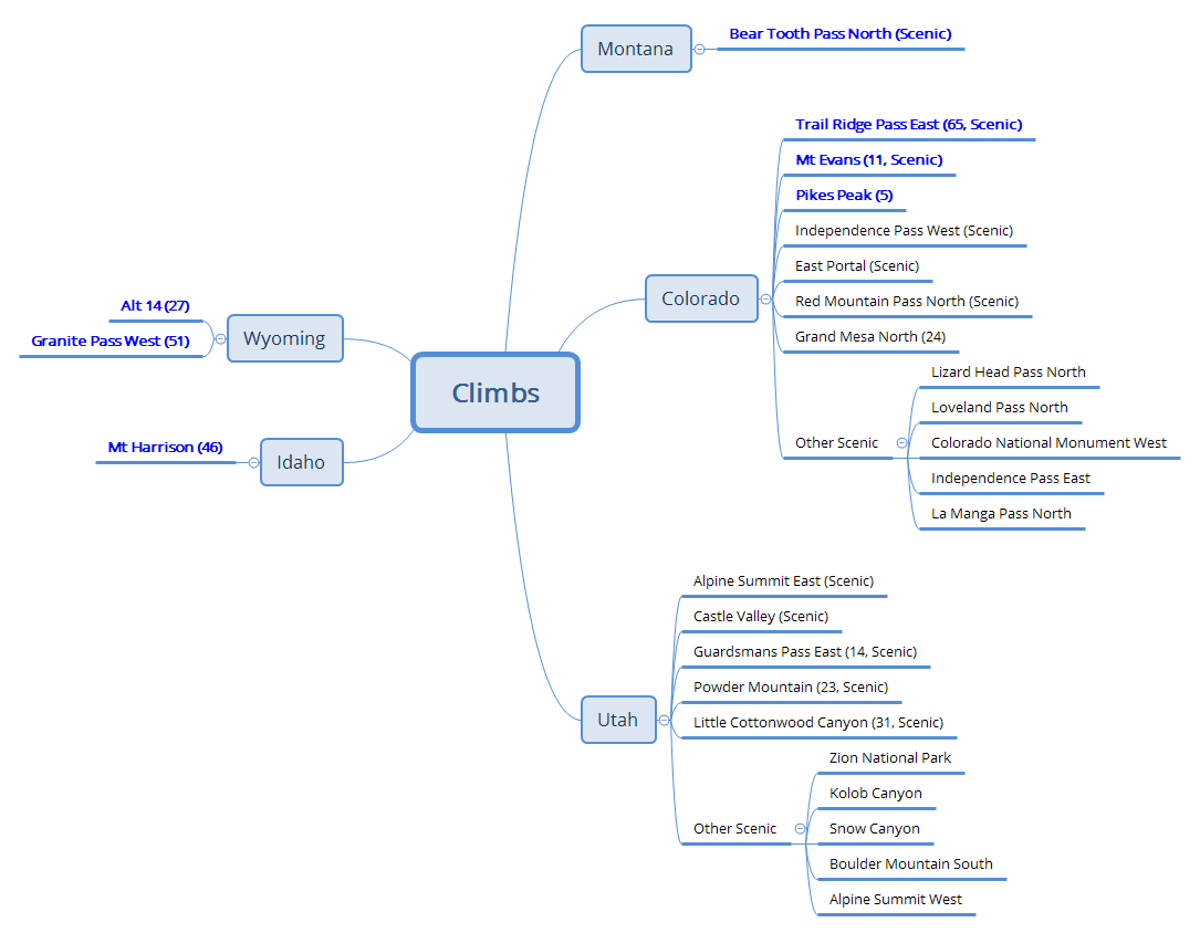
I’m still finalizing my route and targeted climbs, but here’s what it looks like so far (and no, I don’t expect to ride all of these – I imagine I will bag a dozen or so, depending on conditions, weather, fitness, and how the body reacts to multi-hundred mile motorcycle days.
So far, the plan is:
500 miles to Oregon (mostly slab, get outta town!)
500 miles to Albion area (ride Mt Harrison)
Head up to Montana and northern Wyoming
500 miles through Wyoming (ouch) to Colorado
…and then… not sure… Pike’s Peak and Mt Evans are on the list.. we’ll see! Either spend the whole time in Colorado, or if Utah looks good, might head over there.
My most optimistic route home is cutting straight north through Idaho (Another wack at Harrison?) to avoid having to cross Nevada
The climbing mindmap, combination of various websites and books
Serious now.. deleted all my local climbs and starting to populate my segment page on Strava!
Super loose route.. definitely needs refining.. too much super slab